What the Filings Fix About the DNR Sarjapur Road Master Plan
What does exist is unusually good for a project at this stage: two filings with Karnataka's environmental appraisal machinery, one granted and one under examination, which between them fix the land area, the unit count, the total built-up area, the project cost, the regulatory category and the presence of a clubhouse. Those figures constrain the master plan far more tightly than most readers expect. A site plan has to reconcile with them, and when a drawing eventually appears, the numbers below are the ones it will have to satisfy.
The scheme is being referred to in early campaign material as DNR Sarjapur Road; DNR Group has not announced a marketing name, and this page uses the working title only as a label.
| Master plan parameter | Filed value | Source |
|---|---|---|
| Land area | 11.86 acres (4.8 ha) | Granted Terms of Reference, SIA/KA/INFRA2/576225/2026 |
| Land area, later filing | 11.92 acres (4.8256 ha) | Environmental clearance application, SIA/KA/INFRA2/585446/2026 |
| Units | 865 | Granted Terms of Reference |
| Total built-up area | 254,912.84 sq m (about 2.74 million sq ft) | Granted Terms of Reference |
| Project cost | Rs 350 crore (Rs 35,000 lakh) | Granted Terms of Reference |
| Scheme description | "Residential Development plan with Club House" | Granted Terms of Reference, verbatim |
| EIA category and schedule | Category B1, Schedule 8(b) - Townships and Area Development Projects | Granted Terms of Reference |
| Land parcels | Seven survey numbers in Doddakannelli village | Environmental clearance application |
| Land status | Acquired; conversion obtained for Hi-tech purposes | Environmental clearance application |
| Nearest water body | Doddakannelli Lake, roughly 21 m from the parcel edge | Both filings (declared at 0.05 km and 0.02 km) |
| Tower count, floor count, height | Not stated in either filing | - |
That last row is the one to hold on to. Neither document states how many buildings there are, how tall they are, or how the floors stack. Anything you read that supplies those numbers is not reading a filing.
The Land Behind the DNR Sarjapur Road Master Plan
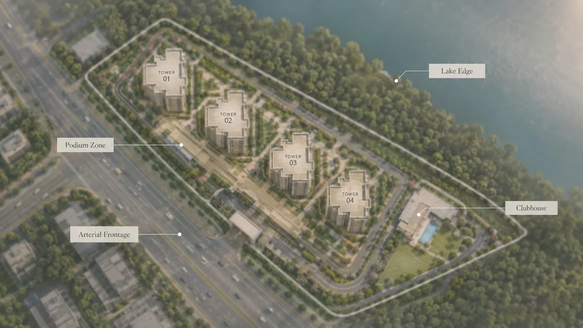
The parcel is an assembly, not a single holding. The environmental clearance application lists seven survey numbers in Doddakannelli village: 115/1, 115/5, 116/15, 116/17, 116/20, 116/25 and 117/3 - three survey blocks stitched into one development site. Assembly shows up in a master plan in ways that matter: the outer boundary is rarely a clean rectangle, internal levels can differ across the original holdings, and the geometry of the eventual layout is set as much by what could be bought as by what a planner would have preferred.
Two other pieces of land history are on the record and are worth reading together. At the Terms of Reference stage in June 2026 the land was declared not acquired; by the environmental clearance application of 20 August 2026 it is declared acquired. The acquisition therefore closed between those two dates. Separately, the land conversion held over the parcel was obtained for Hi-tech purposes rather than for residential use - a common position on this corridor, where Hi-tech conversion was the instrument that opened the Sarjapur belt to development, and a point a buyer's lawyer will want to see squared against the eventual residential sanction.
The two land figures differ slightly - 11.86 acres on the granted Terms of Reference and 11.92 acres on the later clearance application. That is a difference of about six hundredths of an acre, roughly 240 sq m, and it is the kind of movement that comes from a boundary survey being refined between filings. Both are published here rather than averaged, and 11.86 acres is the figure used everywhere on this site for arithmetic, because it comes from the document that has actually been granted.
Density and Built-Up Intensity - the Arithmetic the Plan Must Satisfy
Three derived figures follow from the filed numbers. Each is an estimate produced by us from filed inputs, not a developer statement, and each is shown with its arithmetic so it can be checked.
| Derived figure | Arithmetic | Result |
|---|---|---|
| Filed density | 865 units ÷ 11.86 acres | 72.9 units per acre |
| Gross built-up to land ratio | 254,912.84 sq m ÷ 48,000 sq m | about 5.3 to 1 |
| Gross built-up area per unit | 254,912.84 sq m ÷ 865 units | 294.7 sq m, about 3,172 sq ft |
Each carries a caution.
72.9 units per acre is a genuine multi-storey density. It is not a villa density and not a low-rise garden density; it is the intensity at which parking has to go below grade, circulation has to go vertical, and open space at ground level survives only if the cars do not.
5.3 to 1 is not the sanctioned Floor Area Ratio, and must never be quoted as one. Filed built-up area under the environmental process counts basements, parking decks, service areas, common areas and the clubhouse - all the floorspace that will never appear on anybody's agreement. Sanctioned FAR counts a narrower set. The 5.3 figure tells you the development is vertical and structured; it does not tell you what the planning authority has permitted.
3,172 sq ft per unit is emphatically not a unit size. It is total filed floorspace divided by the unit count, inclusive of everything below and around the homes, and it is published here for one reason only: it is a coherence check on the numbers. The same division against the lower "750+" figure that circulates in campaign material returns about 3,659 sq ft per unit, which is difficult to reconcile with a two-bedroom entry price near the campaign's own quoted level. The filed 865 is the internally consistent figure, and it is the one this site works from.
Building Placement and Site Geometry
The site's geometry is genuinely unusual, and it is the part of the master plan that can be described honestly today because it comes from the land rather than from a drawing.
- South-west frontage on Sarjapur Main Road. The parcel presents its long face to the arterial. Access, visibility and road noise all arrive on this side, and any road-facing elevation inherits all three.
- North-east edge against water. The western tip of Doddakannelli Lake runs up against the far boundary, roughly 21 metres from the parcel edge at the closest point - a figure that independently reproduces the 0.02 km recorded in the clearance application.
- The Bier Library sits about 95 metres away across Sarjapur Main Road, which is the most useful physical marker for locating the site from the carriageway.
A parcel with an arterial on one side and a lake on the other has its planning logic largely written for it. The public face, the entry sequence and the service functions belong to the road edge; the quiet frontage and the view belong to the water edge. That is a reasonable expectation about how any competent designer would use this site. It is not a statement about what DNR has designed, because DNR has not published a design.
What circulating pre-launch material says, and why it is not stated as fact here. Marketing copy in circulation describes five towers lettered A to E, a uniform two-basement plus ground plus twenty-two upper-floor stack, a maximum height of 75.75 metres and a fully vehicle-free central podium with a standalone signature clubhouse. Those are the campaign's descriptions. Neither filing states a tower count, a floor count or a height, the developer's own website carries no page for this project at all, and the material in circulation traces to a shared upstream marketing source rather than to independent confirmation. None of it appears in this page's tables, its headings, or its structured data.
Open Space and Landscape at DNR Sarjapur Road
No open-space ratio has been published by the developer, and none is asserted here. The honest way to think about open space on this parcel is as an arithmetic consequence rather than a marketing figure.
At 72.9 units per acre, ground-level open space is determined almost entirely by one decision: how much of the parking goes underground. If resident and visitor parking for 865 homes sits below grade, a large proportion of the 11.86 acres can be released as landscape, courts and walking ground. If a meaningful share of it sits at grade, the same site reads as a car park with planting around it. That single decision, more than any species list or landscape rendering, is what will determine how this scheme feels to live in.
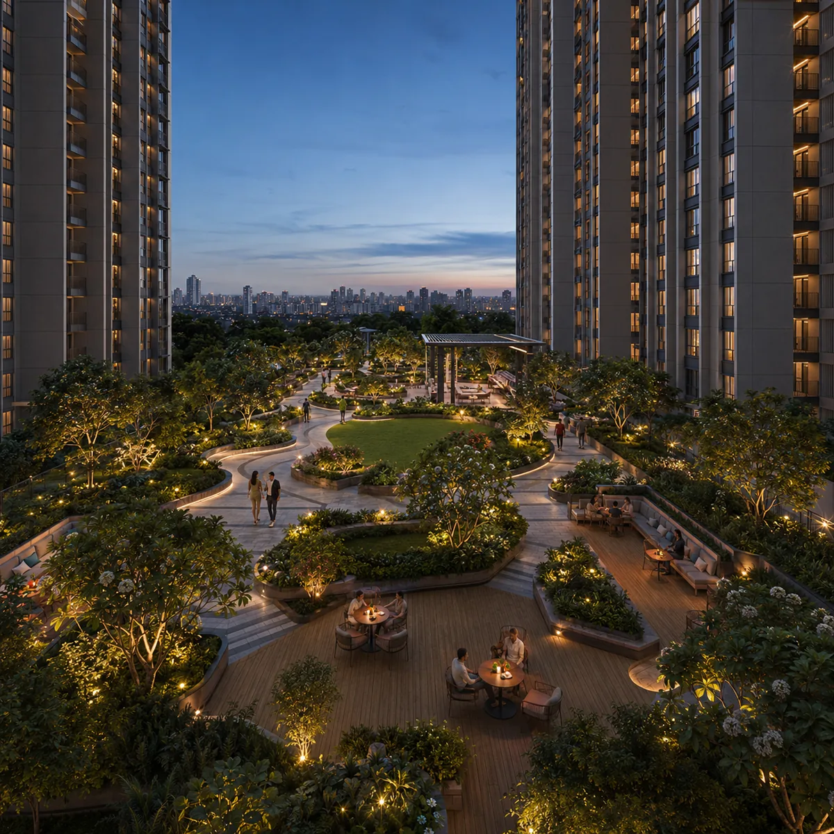
The campaign material describes deep landscaping and pedestrian walking trails over a vehicle-free podium. Taken at face value that is the below-grade-parking answer, which is the good answer. It is also, at this stage, an assertion in marketing copy rather than a drawing anyone has seen. When a layout is released, the number to look for is not the headline percentage but how much of it is usable ground - podium slabs carry limited soil depth, which constrains planting to lawn and shrub rather than mature canopy, and a percentage that counts setbacks, driveway verges and slab edges as "open space" is not measuring the same thing a resident experiences.
One landscape element is fixed by the site itself and needs no drawing: the lake edge. A development that sits 21 metres from open water inherits both an amenity and an obligation, and how the boundary treatment handles that is a legitimate question to put to the developer.
Circulation and Access
Vehicular access can only come off Sarjapur Main Road, on the parcel's south-western face. There is no second arterial frontage.
The good news is the specific stretch of road involved. The 4.7 km Iblur to Carmelaram section of Sarjapur Main Road was widened to a 45 metre right of way and asphalted in 2022, and this parcel sits inside that improved length. For a scheme of 865 homes, an entry and exit onto a full-width divided arterial is a materially better starting position than a project further out on the same road that has to feed the same volume through an unwidened section.
The constraint sits beyond the frontage rather than at it. Bengaluru recorded a city-wide congestion figure of 36 minutes 09 seconds per 10 km in 2025, and the tech-park cluster this site serves is reached through the Outer Ring Road junctions. Access from the gate is good; the journey after the gate is the corridor's known problem.
Routed road distances to the anchors that will shape daily circulation patterns for residents:
| Destination | Routed road distance |
|---|---|
| Wipro Corporate Office, Doddakannelli campus | 0.51 km |
| Carmelaram railway station | 3.47 km |
| Ibbaluru metro station (Blue Line, under construction) | 3.97 km |
| RGA Tech Park | 4.25 km |
| Embassy Tech Village (service road) | 4.44 km |
Every figure above is routed road distance on the OpenStreetMap road network, queried 23 August 2026. No straight-line distance is published anywhere on this site, and at this address the difference is severe enough that map impressions are actively misleading.
Below-Ground Infrastructure
No basement count is filed. The campaign material describes two basement levels; the filings say nothing about basements at all.
What the filings do say is quantitatively useful. The 254,912.84 sq m of built-up area is a gross figure that includes basements, parking, service floors, common areas and the clubhouse. A substantial share of that number is therefore floorspace that will be built, paid for and maintained, and will never appear as saleable area on any agreement. For a buyer, that has a direct consequence: the cost of the below-ground works is inside the Rs 350 crore project cost and inside whatever per-square-foot rate is eventually quoted, whether or not it is ever itemised.
Below-ground infrastructure on a scheme of this scale conventionally carries the parking, the sewage treatment plant, the domestic and fire water tanks, the pump rooms, the transformer and generator plant and the cable and drainage trenching. This site publishes no specification for any of it, because none has been issued. The questions worth asking when a plan is released are specific and answerable: how many parking bays per unit and at what levels, where the ramps land relative to the Sarjapur Main Road entry, what the sewage treatment plant is sized for against 865 households, and whether treated water is returned to landscape irrigation and flushing.
Sustainability and Environmental Infrastructure
This is the part of the project with the most documented substance, and it is also the part most often misdescribed.
Karnataka's State Expert Appraisal Committee granted Standard Terms of Reference for the project on 2 July 2026, and DNR filed its environmental clearance application on 20 August 2026. That application is under examination. Terms of Reference set the scope of the environmental study; they are not an environmental clearance.
The distinction is the whole point. A granted Terms of Reference tells the developer what its environmental impact assessment must study; it does not approve anything about the project's environmental performance. The scheme is filed under Category B1, Schedule 8(b) - Townships and Area Development Projects, and carries proposal number SIA/KA/INFRA2/576225/2026 for the Terms of Reference and SIA/KA/INFRA2/585446/2026 for the clearance application.
Two further items from the record bear on the eventual infrastructure design:
- EIA baseline monitoring ran from 2 March to 30 May 2026 - a summer-season baseline, covering the pre-monsoon window when air and water conditions on this corridor are at their least favourable.
- The declared sensitive receptors include Doddakannelli Lake at 0.02 km and the Doddakannalli built-up area at 0.8 km. A residential scheme filed 21 metres from a lake will be appraised on exactly that adjacency - stormwater, sewage handling and construction-phase runoff - and that appraisal is what the clearance process is for.
No sustainability specification is published here - no rainwater harvesting capacity, no solar provision, no treatment plant sizing, no waste-management scheme - because the developer has issued none and the environmental appraisal that will fix much of it is still open. What can be said is procedural and true: for a scheme in this category, water, sewage, solid waste, air quality and construction-phase management are appraisal subjects rather than optional marketing features, and the commitments made in the clearance process become conditions on the clearance if it is granted.
Statutory Reservations and What Is Not Yet Known
Karnataka's planning framework can require land inside a large development to be set aside for civic amenity and open-space use, with the applicable proportions determined by the sanctioning authority rather than by the developer. No sanctioned plan for this project has been published, so no reservation area, park area or amenity-block footprint can be stated here, and none is invented.
The open items on the master plan, as of today:
| Question | Where the answer will come from |
|---|---|
| Tower count, floor count and building heights | The sanctioned building plan |
| Open-space percentage and how it is measured | The sanctioned layout plan |
| Parking provision, basement levels and ramp positions | The sanctioned building plan |
| Sewage treatment, rainwater harvesting and waste handling | The EIA report and the environmental clearance conditions |
| Civic amenity and park reservations | The sanctioned layout plan |
| Clubhouse size, siting and facility schedule | The developer's own release, and the agreement annexure |
| Unit sizes, carpet areas and configuration mix | The K-RERA registration filing |
The Regulatory Position, Stated Plainly
DNR Sarjapur Road is not registered with the Karnataka Real Estate Regulatory Authority. There is no K-RERA project registration number for this scheme, and this site does not describe it as registered or approved.
That matters directly to the master plan, because K-RERA registration is the point at which a developer's sanctioned plans, unit inventory, common areas and completion timeline enter a public register and become binding. Until then, everything about the layout - including everything on this page - is either a filed environmental parameter or an unpublished design. Under Section 3 of the Real Estate (Regulation and Development) Act 2016, a project cannot be advertised, marketed, booked or sold before it is registered. A reader evaluating this master plan should treat it as a scheme under assessment, not as inventory available to buy.
When the registration is made and the sanctioned plans are lodged with it, this page will be rewritten against those documents rather than against filings that were only ever designed to scope an environmental study.
DNR Sarjapur Road master plan FAQ
The land position, the filed built-up area, and what the scale implies about the built form.
How large is the land, and what is its survey and conversion position?
The granted Terms of Reference records 4.8 hectares, which is 11.86 acres; the later environmental clearance application records 4.8256 hectares, or 11.92 acres. The small difference between the two is the difference between the scoping filing and the fuller application, and both are official. The parcel is assembled from seven survey numbers in Doddakannelli village - 115/1, 115/5, 116/15, 116/17, 116/20, 116/25 and 117/3 - and land conversion has been obtained for Hi-tech purposes. Land status moved from "not acquired" at the Terms of Reference stage to "acquired" in the August 2026 application, so the acquisition closed between June and August 2026.
What are the filed built-up area and project cost at DNR Sarjapur Road?
The granted Terms of Reference records 254,912.84 sq m of built-up area - about 2.744 million sq ft - and a project cost of Rs 35,000 lakh, that is Rs 350 crore. Those are the developer's own declared figures to the regulator, which makes them a firmer guide to the scheme's intended scale than any brochure number. Built-up area in an environmental filing is a gross figure: it includes basements, parking, circulation, common areas and the clubhouse, so it is not the saleable area and should never be divided by a price to produce a rate. A cost figure appearing in the later application is a clear data-entry error and is not reproduced anywhere on this site.
What does the filed scale tell us about the built form at DNR Sarjapur Road?
Working from the filed figures alone: 865 units across 11.86 acres is about 72.9 units per acre, and 254,912.84 sq m of built-up area across 865 units is about 294.7 sq m, roughly 3,172 sq ft, of gross built-up area per unit. Both are our own estimates from the filing's own totals, and both point the same way - a high-rise, multi-block scheme with substantial basement and podium volume rather than a low-rise layout. A Rs 350 crore project cost across 2.744 million sq ft of built-up area is consistent with a mainstream premium build rather than an ultra-luxury one. None of this replaces a master plan; it simply bounds what the filed numbers can support.
How many towers and floors will DNR Sarjapur Road have?
The granted Terms of Reference states neither. Pre-launch campaign material in circulation describes five towers lettered A to E, each at two basements plus ground plus 22 upper floors, with a maximum height of 75.75 metres - but that configuration appears only in marketing copy, not in any filing, and DNR has published nothing about the project on its own website. Treat it as an indication of intent from a promotional source, not as a specification. The filed figures that do exist - 11.86 acres, 865 units and 254,912.84 sq m of built-up area - are consistent with a multi-tower high-rise scheme, but they do not confirm any particular tower count or height.
What approvals does DNR Sarjapur Road actually hold today?
Karnataka's State Expert Appraisal Committee granted Standard Terms of Reference for the project on 2 July 2026, and DNR filed its environmental clearance application on 20 August 2026; that application is under examination. Terms of Reference set the scope of the environmental study; they are not an environmental clearance, and this project should not be described as though it already held one. The scheme is classified Category B1 under Schedule 8(b), townships and area development projects, with state file number SEIAA 219 CON 2026 and ToR identification number TO26B3813KA5630370N. The environmental clearance application records baseline monitoring carried out between 2 March and 30 May 2026, covering the summer season.
Ask for the DNR Sarjapur Road filings
The land extent, the unit count, the built-up area and the project cost on this page come off public records. Ask and we will send them.
Contact us